


Bogueloosa, Choctaw County, Alabama
About
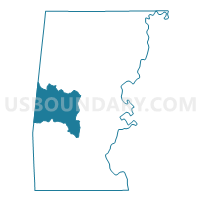
Outline

Summary
| Unique Area Identifier | 521375 |
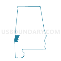
| Name | Bogueloosa |
| County | Choctaw County |
| State | Alabama |
| Area (square miles) | 83.82 |
| Land Area (square miles) | 83.82 |
| Water Area (square miles) | 0.00 |
| % of Land Area | 100.00 |
| % of Water Area | 0.00 |
| Latitude of the Internal Point | 31.98076160 |
| Longtitude of the Internal Point | -88.37248720 |
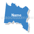
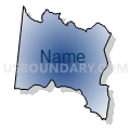
Maps

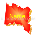
Graphs
Select a template below for downloading or customizing gragh for Bogueloosa, Choctaw County, Alabama


Neighbors
Neighoring Voting District (by Name) Neighboring Voting District on the Map
- Barrytown-Womack Hill-Chappell Hill, Choctaw County, AL
- Butler-Lavaca-Mt. Sterling Voting District, Choctaw County, AL
- Lusk-Pleasant Valley-Ararat Voting District, Choctaw County, AL
- Pineridge Voting District, Clarke County, MS
- Riderwood-Rock Springs, Choctaw County, AL
- Springs Voting District, Clarke County, MS
- Toxey-Gilbertown-Melvin-Hurricane Voting District, Choctaw County, AL
Top 10 Neighboring County Subdivision (by Population) Neighboring County Subdivision on the Map
- Butler CCD, Choctaw County, AL (4,423)
- Gilbertown-Toxey CCD, Choctaw County, AL (3,879)
- District 4, Clarke County, MS (3,050)
- District 5, Clarke County, MS (2,517)
Top 10 Neighboring Place (by Population) Neighboring Place on the Map
Top 10 Neighboring Unified School District (by Population) Neighboring Unified School District on the Map
Top 10 Neighboring State Legislative District Lower Chamber (by Population) Neighboring State Legislative District Lower Chamber on the Map
Top 10 Neighboring State Legislative District Upper Chamber (by Population) Neighboring State Legislative District Upper Chamber on the Map
Top 10 Neighboring 111th Congressional District (by Population) Neighboring 111th Congressional District on the Map
Top 10 Neighboring Census Tract (by Population) Neighboring Census Tract on the Map
- Census Tract 9568, Choctaw County, AL (4,423)
- Census Tract 9501, Clarke County, MS (4,359)
- Census Tract 9569, Choctaw County, AL (3,879)
Top 10 Neighboring 5-Digit ZIP Code Tabulation Area (by Population) Neighboring 5-Digit ZIP Code Tabulation Area on the Map
- 39367, MS (15,096)
- 39355, MS (7,131)
- 36904, AL (4,098)
- 36908, AL (2,417)
- 36921, AL (1,035)
- 36915, AL (627)
- 36913, AL (53)